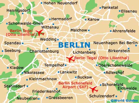
Berlin Tegel (Otto Lilienthal) Airport (TXL)
Orientation and Maps
(Berlin, Germany)
Germany's bustling capital city, Berlin is a modern city, full of life and action. Known for its prominent landmarks, the shape of Berlin changed dramatically towards the end of the 20th century, when the famous Berlin Wall was finally demolished, unifying the city as one. However, two main centres do still remain, in the east and the west.
Home to three separate airports, Berlin Tegel / Otto Lilienthal Airport (TXL) lies on the north-western side of the city and is easy to reach. Within the city itself, public transport is excellent, with buses, trams, S-Bahn trains (the electric surface railway) and U-Bahn trains (the underground railway).
Berlin Tegel (Otto Lilienthal) Airport (TXL) Maps: Important City Districts
Berlin is not only the capital city but the largest in the whole of Germany, with a population of around 3.5 million residents. Attractions are available in Berlin 24-hours-a-day and appeal to all age groups and tastes.
The federal state of Bundesland surrounds the city and is home to a number of prominent parklands, wooded areas and large lakes. Within the city itself, Berlin is based around the Spree River, which joins the vast Grosser Müggelsee Lake to the east.
In recent years, the number of districts in Berlin has been rationlised, with the main areas including Charlottenburg, Kreuzberg, Mitte and Tiergarten. Many of these are split into smaller communities and neighbourhoods.
Germany Map

Berlin Map